Home › Features

Step 4 In the field

Log your finds, know your flint, and keep your maps offline

Mark a find right where you stand, check a flint against the built-in guide, and keep your maps working where your phone has no signal.

Made for one hand, out in the field

Big buttons along the bottom. A field's page that slides up over the map. A clean map when you just want to see the ground.

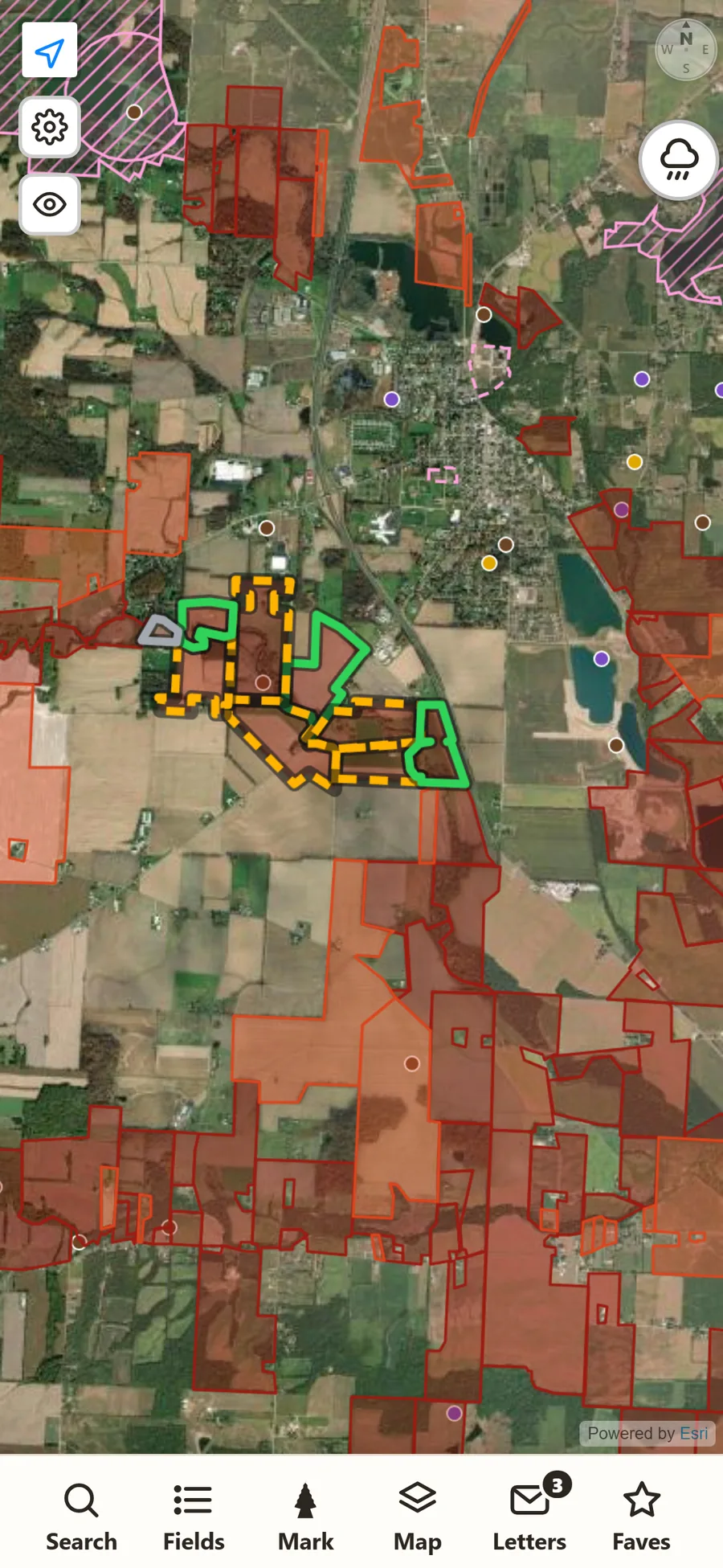
The app on a phone: crop fields outlined in red over a satellite map, with a bar of big buttons along the bottom: Search, Fields, Mark, Map, Letters and Faves.
The map. The darker red the field, the higher it scores. Everything else is one tap away along the bottom.
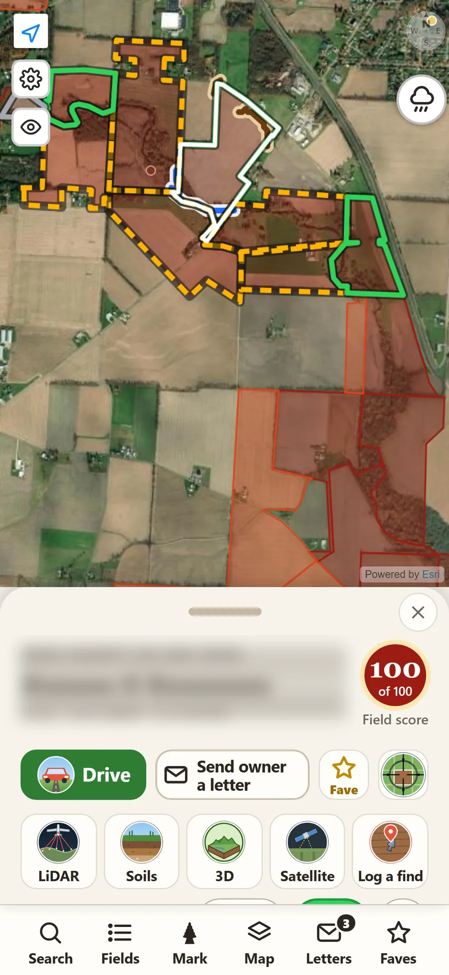
A field open in the app: its page sits low over the map with a score of 100, Drive and Send owner a letter buttons, a star, and five tools: LiDAR, Soils, 3D, Satellite and Log a find. The owner's name is blurred.
A field's page, half open. The field stays in view on the map, with Drive, Send owner a letter and the five tools right under your thumb. Pull it up for the full page.
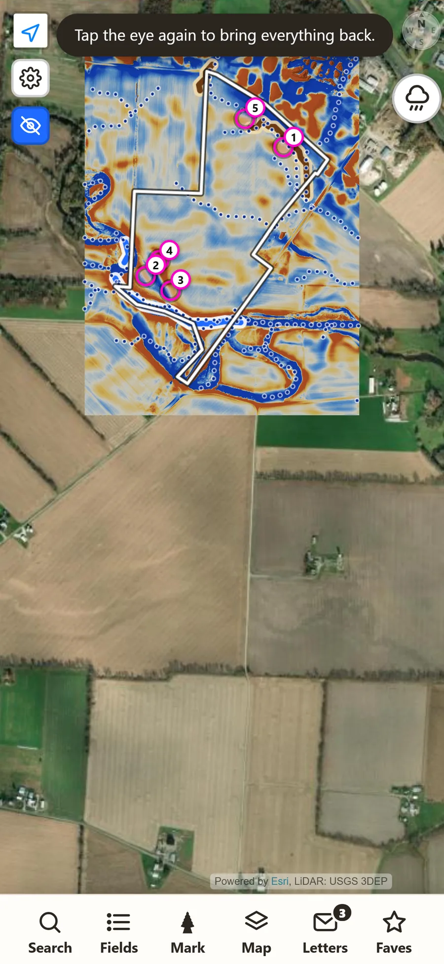
The clean map: only the LiDAR picture of one field and its numbered hot spots over the satellite map, with nothing else on the screen.
The clean map. One tap on the eye hides everything but the LiDAR, its hot spots and the field.

Swipe to see all three.

Screens below are from the app; the current version may look a little different. Owner names and places are hidden.

Log your finds

Mark the spot, right where you stand

Tap Mark on the bottom bar and pick what you found: a point, a tool, a preform. While you hold still, the app keeps the best GPS readings and tells you how close the fix is, so the pin lands as near the spot as your phone allows.

Add a note and photos. It works with no signal and saves when you're back in range. Only you can see your finds.
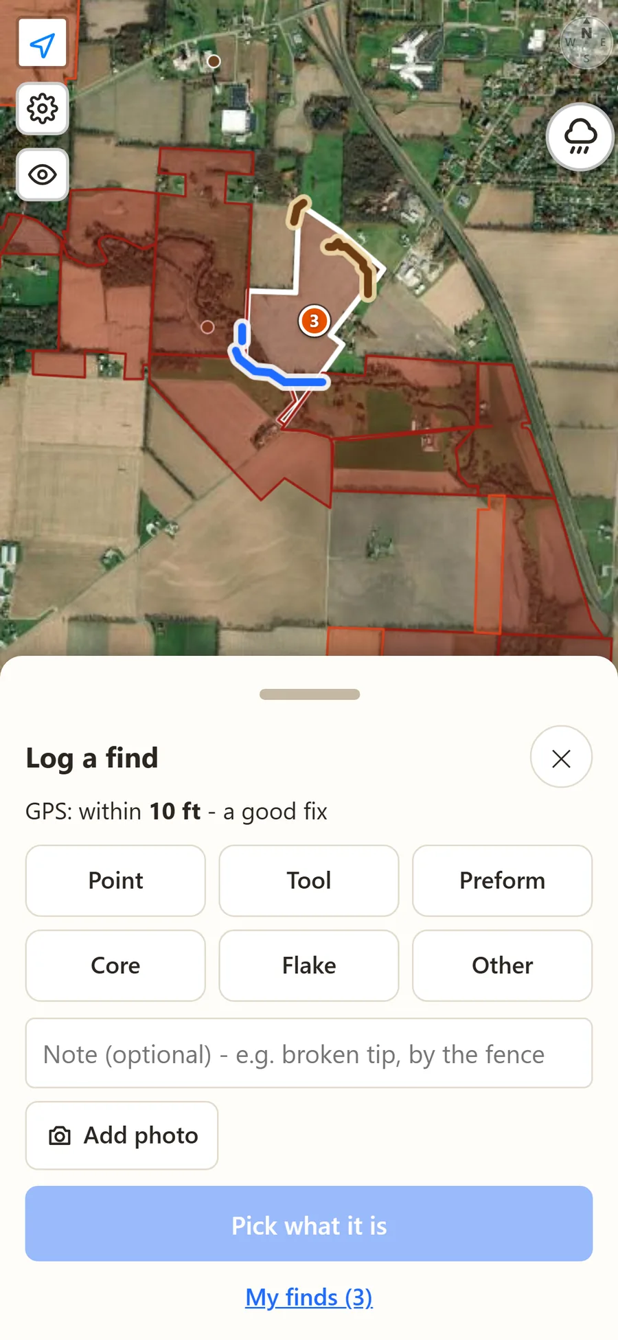
The Log a find sheet: GPS within 26 feet and still improving, buttons for point, tool, preform, core, flake and other, a note box and Add photo.

Flint guide

Know your flint

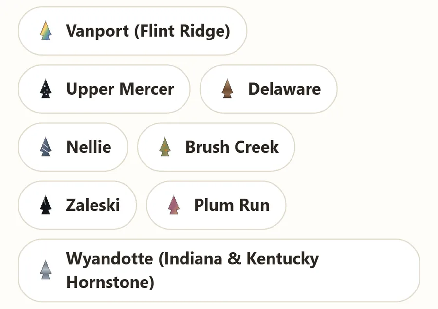
A built-in guide to the flints of the region, with photos and plain descriptions: Vanport (Flint Ridge), Upper Mercer (Coshocton Black), Delaware, Nellie, Brush Creek, Zaleski and Plum Run, plus Wyandotte hornstone, traded in from Indiana and Kentucky. Each one has its own painted icon, so you can pick it out at a glance.

Each field lists the flints you are likely to find there and how far away each source is.

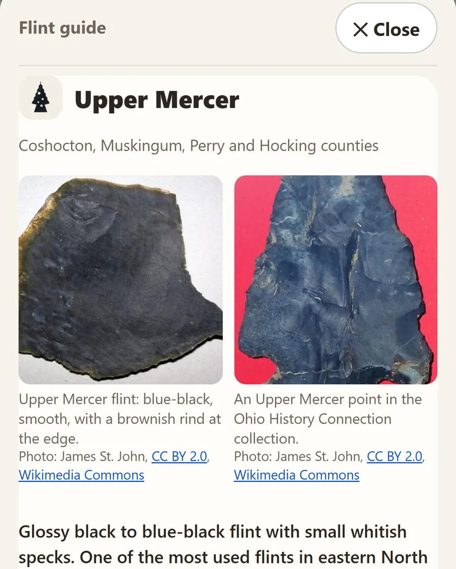
A flint guide card for Upper Mercer with two photos: blue-black flint with a brownish rind, and an Upper Mercer point.
A flint's card, with photos and what to look for.
The flint guide's list: Vanport, Upper Mercer, Delaware, Nellie, Brush Creek, Zaleski, Plum Run and Wyandotte, each with a small painted arrowhead in that flint's colors.
Painted icons in each flint's own colors.

Swipe to see both.

Maps

Old maps, topo lines and offline maps

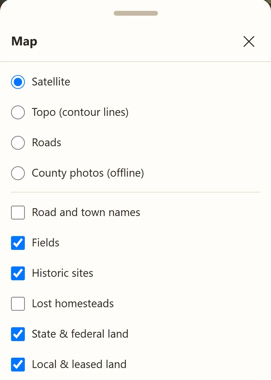
Switch on historic sites from the 1914 Mills atlas, lost homesteads (house sites on the old USGS maps that are gone today), topo contour lines, roads and place names, all from the Map button.

Download a county at home on Wi-Fi, and its fields, LiDAR maps, hot spots and aerial photos keep working in fields with no signal.

The Map panel: satellite, topo contour lines, roads and county photos offline, then road and town names, fields, historic sites, lost homesteads and public land.

Also in the app

  • Search: find a town, a road or a landowner, and slide the score to see only the best fields.
  • Field numbers: each scored field has a short number to search for or share with a friend.
  • Faves: star the fields you want to come back to. They're one tap away on the bottom bar.
  • Permission letters: tap Send owner a letter on a field. More about letters.